An Original Version of the “Indian“ Map
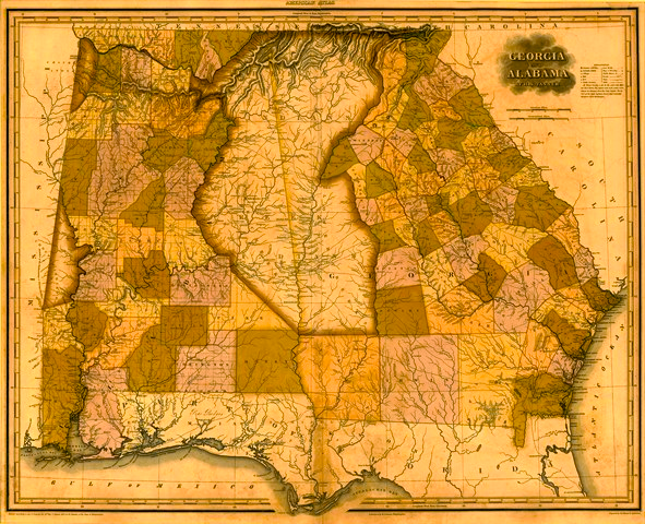
This fascinating map from the early 1820’s shows how some states were, legally, shaped differently than they would appear on any simple map of the United States. The map is in the collection of Sheffield Hale, CEO of the Atlanta History Center. It shows Georgia and Alabama, which today are separated mostly by an imaginary line. That line is lightly visible here – but so is a vast oblong region in the middle of the map that was beyond each state’s control. It was “Indian country.” To the north is the Cherokee Nation. To the south is the last remnant of the Creek Nation. The checkerboard pattern on all sides shows counties recently established through white settlement – in some cases very recently established. The land west and south of the Indian territories had just been taken from the Creeks in 1814 by Andrew Jackson, who took 23 million acres by treaty after the Battle of Horseshoe Bend. These maps show the basic conflict of Jacksonland – between the “white man’s map” of the map of U.S. states, and the “Indian map,” which showed five Indian nations covering much of the same territory.