Literacy in Jacksonland
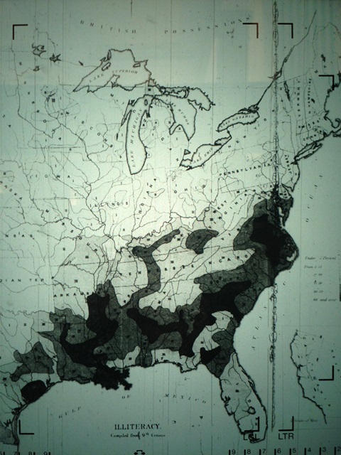
The map comes from a book by Catharine Beecher, who campaigned against the Indian Removal Act of 1830. By profession Beecher was an educator. And when she wrote a memoir in 1874, she titled it “Educational Reminiscences and Suggestions.” It was natural, then, that she included a map showing postwar literacy in the United States. The darker the hue, the higher the rate of illiteracy. North of the Ohio, the ability to read and write on some level is nearly universal.
Not so in the South. In the areas shaded black, 60% or more of those examined were unable to read or write. Many of the very worst areas correspond with the Black Belt, the region dominated by cotton plantations, which had once been worked by slaves who were given little chance at education or even forbidden it. The slaves were freed by 1865, but had had little chance by 1874 to catch up. White families, other than elites, were not necessarily that much better off. Many of the black or dark gray areas of the South are Jacksonland – former Indian areas cleared by Andrew Jackson for white settlement.