Posts Tagged ‘Readers Content’
The Defensive Wall That Became a Trap
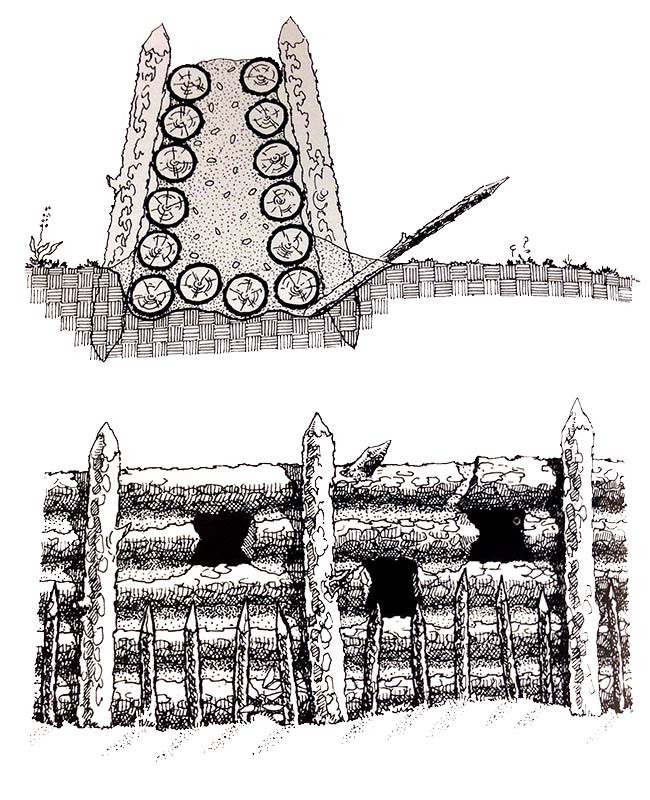
This illustration shows the wall Creek Indians built for defense before the Battle of Horseshoe Bend in 1814. It was drawn for “Archaeological Investigations at Horseshoe Bend, National Military Park, Alabama” by Roy S. Dickens, a book that examined the surviving evidence at the scene of one of General Andrew Jackson’s great military triumphs.
Read MoreThe Wooden Indian in a Former Indian Settlement
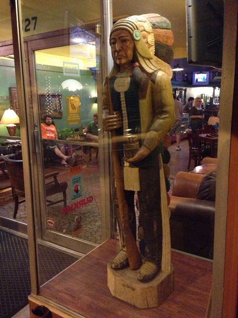
This is a scene from the city of Rome, in north Georgia. In the 19th century this was Cherokee country, a mostly aagricultural area. The nearest settlement was called Ridge’s Ferry. Major Ridge, a prominent Cherokee planter, owned the ferry as well as a store and his plantation house, surrounded by fields where his enslaved laborers harvested cotton and other crops.
Read MoreThe City Where Andrew Jackson Looms Largest
It is, of course, New Orleans, which Jackson defended in the War of 1812. Slightly east of the city in 1815, he wrecked a professional British army with his improvised force of amateurs. It was considered an act of divine Providence in its time. Today it is possible to ascribe the victory to more prosaic causes. General Jackson was determined, confident, attentive to detail – and ruthless in putting down dissent within New Orleans itself. He was also a gifted leader who stitched together an army out of Kentucky and Tennessee frontiersmen, black and white New Orleans militiamen, Choctaw Indians, and even local pirates. And he placed them in a defensible spot behind a canal.
Read MoreChief John Ross of the Cherokee Nation
“Steve: I was inspired by your book and have been following your Facebook updates regarding Jacksonland. I enjoy linocut relief prints and when I saw this campaign, I figured it was worth capturing my emotions about Chief Ross into some original art.”
Read More“Chiefin’”: 1960’s Tourism in Cherokee Country
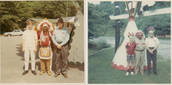
“During our vacation visits to the Smoky Mountains in the summer, my grandfather loved to talk about his Cherokee ancestor. He always made sure we had a picture made with one of the Cherokees at a souvenir stand. I later learned that they refer to this as ‘Chiefin.’ It seems horrifyingly inappropriate now, but at the time, I can assure you there was no disrespect intended.”
Read MoreAn Original Version of the “Indian“ Map
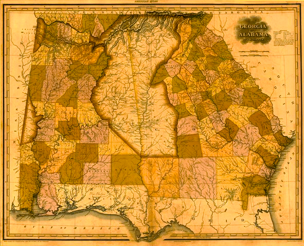
This fascinating map from the early 1820’s shows how some states were, legally, shaped differently than they would appear on any simple map of the United States. The map is in the collection of Sheffield Hale, CEO of the Atlanta History Center. It shows Georgia and Alabama, which today are separated mostly by an imaginary line.
Read MoreHeart at Blue Hole
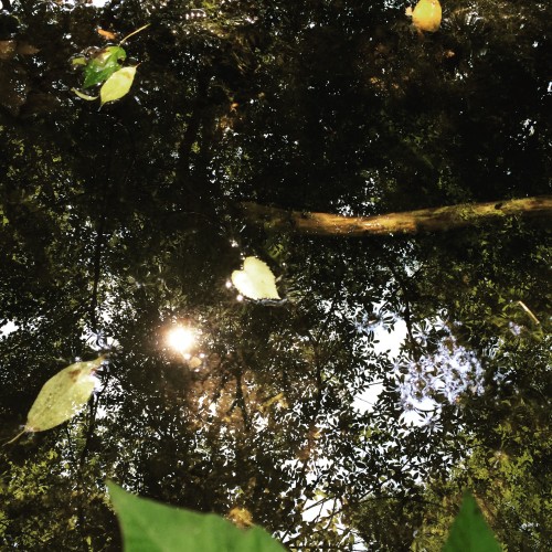
“The Blue Hole is a natural spring located in Red Clay State Historic Park. The Cherokee used this for their water supply during council meetings. My father and I were able to drink from it while retracing our ancestors’ journey along the Northern Route of the Trail of Tears.”
Read MoreSwimmer and cabin – Cherokee Reservation, Qualla Boundary, NC
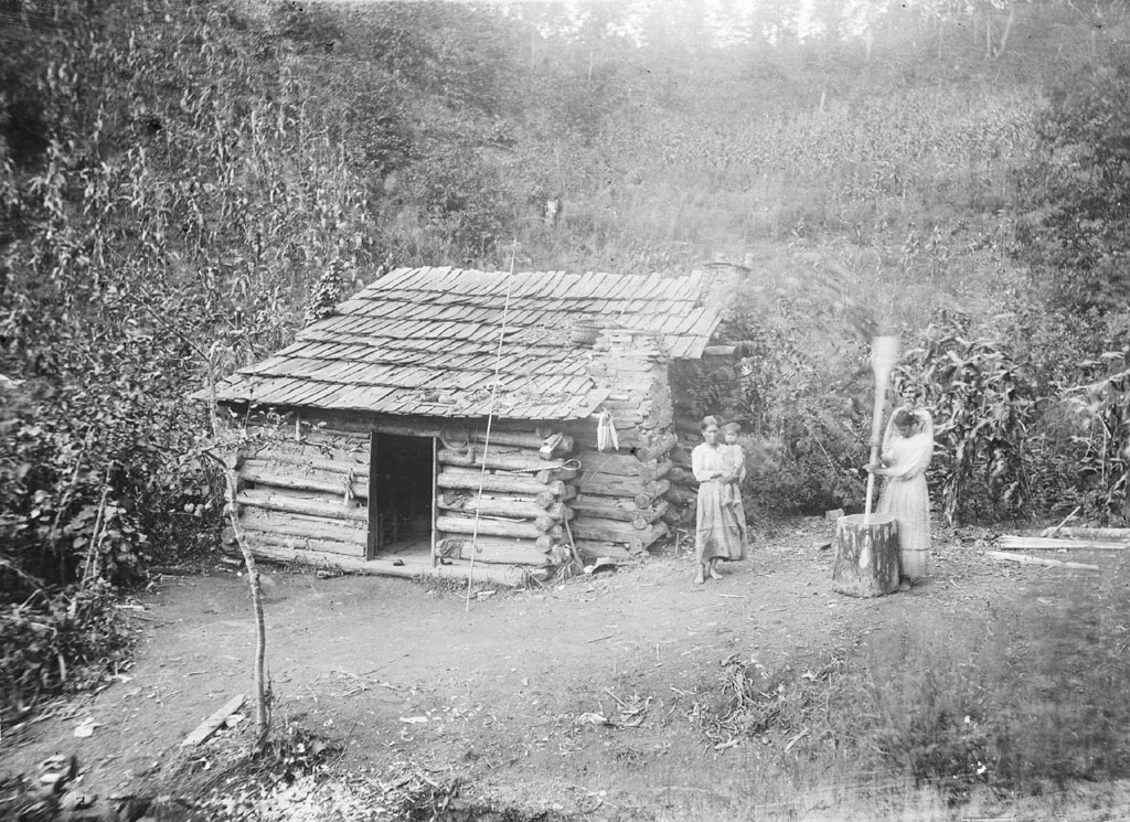
James Mooney was an ethnographer who lived among Cherokees in the late 1800’s. He recorded many of their myths and oral histories, including a very influential account of the Trail of Tears which includes eyewitness memories of the ordeal. Jacksonland uncovers new or little-noticed accounts that offer a still fuller picture of the episode.
Read MoreLooking Out Over the Little Tennessee River
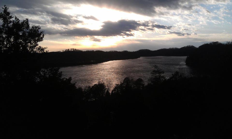
“I fell in love with this part of the country the moment I saw this view.”
Read MoreRoss’s Landing – Now Chattanooga – from Lookout Mountain
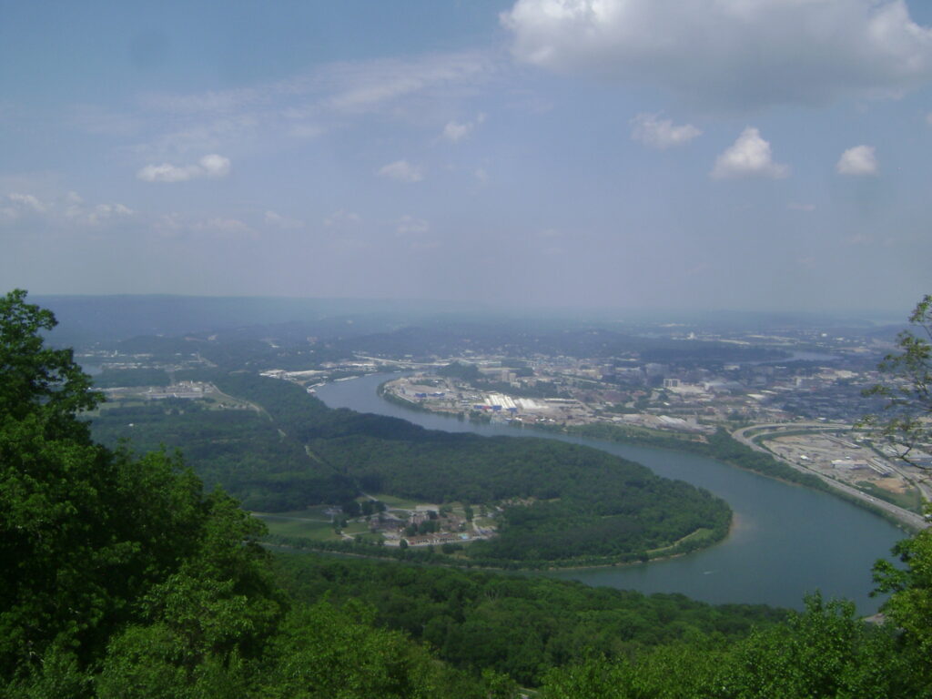
“I was just back home in Chattanooga for a visit after many years away. We started to celebrate John Ross more with the 1980s rebirth of the City at the River.”
Read More